Shopping for a waterfront home in Fort Myers and keep seeing “Gulf-access” in the listing? If you plan to boat, fish, or just cruise to Sanibel for lunch, the kind of access behind that phrase will shape your day-to-day life. You want a clear picture before you buy. In this guide, you’ll learn the types of Gulf access, how bridges and depth affect your boat choice and home search, and what a typical run to the Gulf looks like from Fort Myers canals and the Caloosahatchee River. Let’s dive in.
What Gulf-access means in Fort Myers
“Gulf-access” means you can travel by water from your property or its connected waterway to the Gulf of Mexico without hauling your boat over land. In Fort Myers, that access can look very different from one address to another.
Three common access types
- Direct/open water: No fixed bridges between your dock and the Gulf. You typically run into San Carlos Bay or Estero Bay and then out to the Gulf.
- Canal or river with fixed bridges: You reach the Gulf through canals or the Caloosahatchee River but must pass under fixed-span bridges. Vertical clearance limits your boat’s air draft.
- Canal or river with movable bridges or locks: Draw, bascule, or swing bridges may open on schedules. Locks can add time, fees, and operating rules if you venture inland along the Okeechobee Waterway.
Why the type matters to you
Your route determines what boats will fit, how easily you can cruise, and how long it takes to reach open water. Direct access offers speed and fewer restrictions but more exposure to wind and surge. Canal routes can be calmer and more protected but may add transit time and bridge planning.
Direct, bridge, and lock access explained
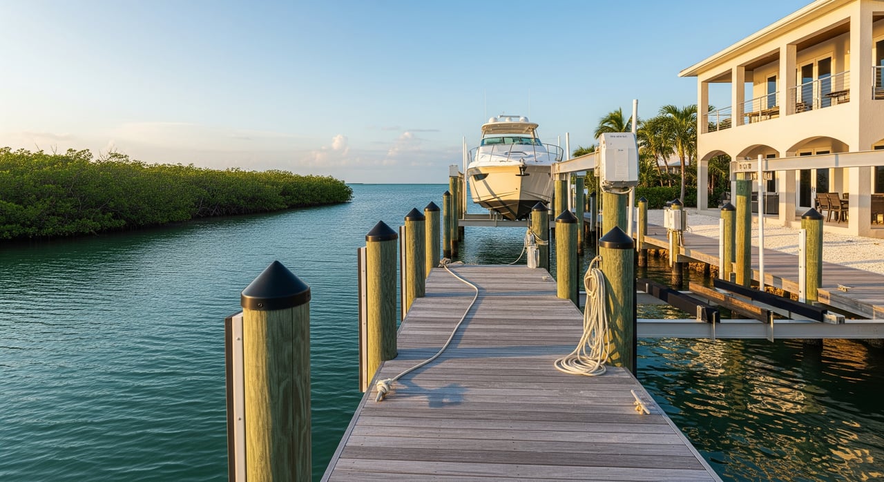
Direct or open-water access
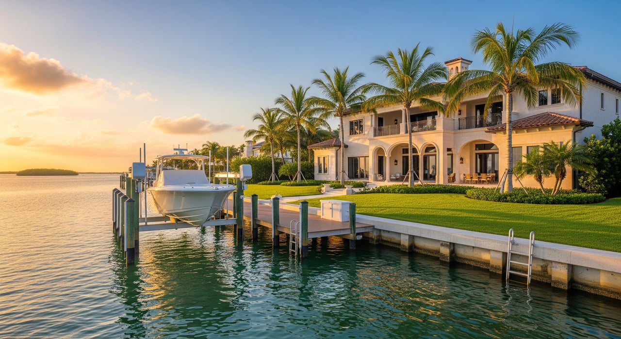
Direct access properties sit on or near San Carlos Bay, some stretches of Estero Bay, or barrier-island-facing shorelines. You have quick passage to open water, often with deeper water near docks. This is popular with larger powerboats because there are fewer height or depth constraints. Expect greater exposure to wind, chop, and storm surge, which can influence insurance and maintenance decisions.
Canal or river with fixed bridges
Many Fort Myers homes connect to the Gulf via canals that feed the Caloosahatchee River and then San Carlos Bay. Fixed bridges along these routes set a maximum vertical clearance at approximately Mean High Water. If your boat’s air draft exceeds that clearance, you cannot pass. Depth can also pinch draft at low water, especially in private canals or older basins.
Movable bridges and locks
Movable bridges can open to allow taller vessels, but they follow posted rules and schedules. If you plan extended inland cruising along the Okeechobee Waterway, you will encounter locks managed by federal authorities. Locks and scheduled openings add time and operational steps to your trip. It is smart to confirm current operating rules before assuming unimpeded access.
How access type shapes your boat choice
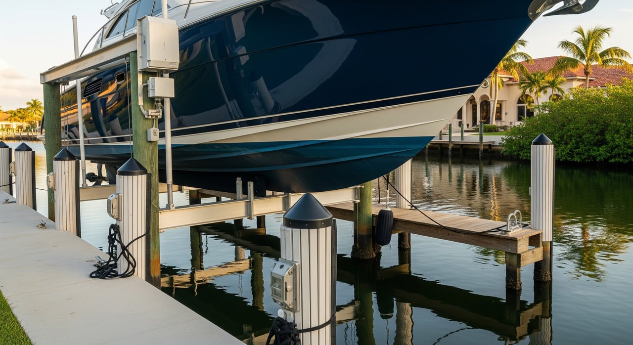
Depth, air draft, and slip size
Four physical constraints guide your decision:
- Depth at MLW: Depth at Mean Low Water sets your safe draft. Shallow canals favor shallow-draft boats.
- Air draft: The height of your boat from waterline to the tallest fixed point determines whether you clear fixed bridges.
- Slip length and beam: Dock and marina slips have limits on length and width. Beam matters for wider hulls.
- Turning room: Narrow canals can challenge longer or wide-beam boats when docking or turning.
What fits common canals
- Small runabouts and center consoles: Usually fine in most canals and private docks unless depths are very shallow.
- Express cruisers and sportfish (30–50+ ft): Often need deeper water, longer slips, and more maneuvering room. Direct or well-dredged canals are preferred.
- Sailboats: Tall masts require adequate bridge clearance or reliance on movable bridges where available.
- Liveaboard or long-range cruisers: Look for direct access or marinas with deep-water slips, fuel, and provisioning.
Practical checklist for your search
Use this quick list when you evaluate a property:
- Verify water depth at the dock at Mean Low Water and ask about any dredging history.
- Map the distance and route from the dock to the marked channel, then to San Carlos Bay and the Gulf. Estimate transit time.
- Identify all fixed bridges on the route and confirm published vertical clearances at high tide.
- Check whether any movable bridges or locks are on your route and note schedules.
- Confirm an existing dock permit, seawall records, and whether approvals transfer with the property.
- Review HOA or neighborhood rules that may limit boat size, storage, or lifts.
- Note proximity to fuel, pump-out, haul-out, and marine service providers.
Authoritative sources include NOAA nautical charts and tide tables for depths and tides, Florida Department of Transportation for bridge operations, the U.S. Army Corps of Engineers for Okeechobee Waterway lock details, and Lee County departments for permits and seawall rules.
Fort Myers boating routes you will use
From your dock to the Gulf
The Caloosahatchee River runs through Fort Myers and opens into San Carlos Bay. Most Gulf-bound trips follow marked channels into the bay, then pass around Sanibel Island or through nearby inlets to reach open Gulf water. Many homes enjoy a 10 to 30 minute run to San Carlos Bay, but actual times depend on your exact location, boat speed, tides, and no-wake zones.
Tides, no-wake zones, and seasons
Southwest Florida’s tides are modest but they affect safe depths and timing at bridges and shallow spots. Wind and current can also shift water levels. Expect designated manatee protection zones, no-wake areas, and posted speed limits along parts of the river and canals. Seasonal water-quality changes, including freshwater releases upstream, can affect clarity and salinity. Red tide and other blooms may also influence when and where you choose to cruise.
Planning longer trips inland
If you plan to cruise inland, the Caloosahatchee is part of the Okeechobee Waterway that connects to the Atlantic via a series of locks and canals. Locks have size and operating constraints, and transits take planning. Check the latest U.S. Army Corps guidance before setting a schedule.
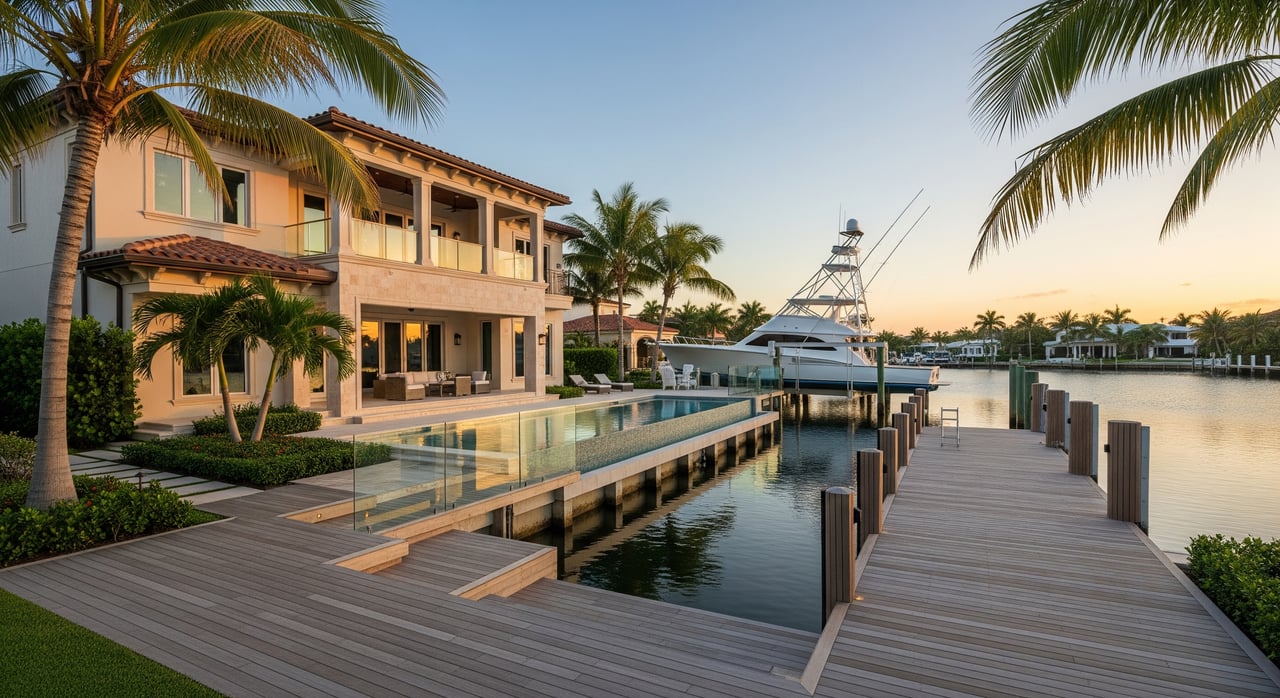
Ownership realities: permits, insurance, and costs
Dock and seawall permitting
Docks and seawalls in Lee County typically require permits, and permit transferability can vary. Ask for copies of existing permits and recent inspections. Local rules govern riparian rights, setbacks, dock dimensions, and shoreline hardening. Build time and costs into your plans if you intend to add a lift or modify the seawall.
Flood, surge, and insurance
Waterfront homes are often in FEMA flood zones and may require flood insurance. Elevation, seawall condition, and exposure to open water influence premiums. Boat owners should carry appropriate hull and liability coverage and plan for salt corrosion and wind events. Hurricane readiness is a key part of ownership on the coast.
Maintenance and marine services
Seawall repair, occasional dredging, and dock upkeep are expected over time. If you prefer marina storage, compare slip depth at MLW, length, power, water, haul-out capacity, and on-site services. Fuel and provisioning access can save time if you run offshore regularly.
Lifestyle tradeoffs to consider
- Transit time: Direct access shortens runs to offshore fishing and sunset cruises. Canal properties may add time and require timing around bridges and tides.
- Shelter: Canals can be calmer and quieter. Open-water locations can see more wind and boat traffic.
- Experience level: Newer boaters often appreciate simpler, direct routes. Experienced boaters may prefer sheltered canals for protection during weather shifts.
How Sea Shep helps you choose with confidence
Gulf-access is about more than a view. It is about the boats you run, the routes you use, and the time you spend on the water. You deserve clear, practical answers before you make a move. With a Gulf-access specialization and a concierge approach, Sea Shep guides you through depth checks, bridge planning, dock permits, and lifestyle tradeoffs so your home fits your boating plans.
Ready to align your next home with your boat and your lifestyle? Connect with Chuck Shepherd to start your Gulf-access search.
FAQs
What does “Gulf-access” mean in Fort Myers real estate?
- It means you can travel by water from the property’s waterway network to the Gulf of Mexico without trailering your boat, though routes and restrictions vary by location.
How do fixed bridges affect my boat choice?
- Fixed bridges set a maximum vertical clearance at high tide, so your boat’s air draft must be lower than that number to pass safely.
How long is the run from Fort Myers canals to open water?
- Many properties see a 10 to 30 minute run to San Carlos Bay, but your actual time depends on slip location, boat speed, channel routing, and no-wake zones.
Where do I find reliable tide and chart information?
- NOAA nautical charts and tide tables provide official depths, marked channels, and tide predictions for the Caloosahatchee River and San Carlos Bay.
Do I need permits to add or modify a dock in Lee County?
- Most docks and seawalls require permits, so request existing permits and consult Lee County building and environmental departments before planning changes.
Are there locks or movable bridges on routes I might use?
- Movable bridges operate on schedules and locks apply if you cruise inland on the Okeechobee Waterway, so confirm current operating rules before you go.
What should first-time Gulf-access buyers verify during due diligence?
- Confirm dock depth at Mean Low Water, bridge clearances at high tide, route and transit time, dock permits, HOA rules, and proximity to fuel and service options.