Wondering whether a Cape Coral waterfront home gives you true Gulf access or just a great canal view? You are not alone. For many buyers, the biggest confusion is not price or lot size, but how a property’s canal type, route, and bridge limitations affect the way you actually boat. This guide breaks down Cape Coral boating access zones and bridge heights in simple terms so you can better match your home search to your lifestyle. Let’s dive in.
Start With Canal Type
In Cape Coral, boating access starts with one basic question: Is the canal freshwater or saltwater? The city says Cape Coral has more than 400 miles of canals, including more than 150 linear miles of saltwater canals and more than 250 linear miles of freshwater canals. The city also uses weirs to keep those systems separated, which means freshwater and saltwater routes do not function the same way for boaters. You can review the city’s canal and boating overview on the Cape Coral boating page.
That difference matters when you are buying. A freshwater canal can still support a fun waterfront lifestyle, but it usually means inland cruising, paddling, and lake access rather than direct boating to the river or Gulf. A saltwater canal is where Gulf-access conversations usually begin, but even then, not every saltwater location offers the same route or level of convenience.
Cape Coral Access Zones Explained
A helpful way to understand Cape Coral is to think in broad boating zones rather than just by neighborhood name. A city-published Canalwatch report groups the city into freshwater regions FW-G, FW-N, and FW-S, plus saltwater regions SW-N, SW-SE, and SW-SS. That report gives you a practical shorthand for understanding how different parts of the city function on the water.
Freshwater Zones
The Canalwatch report identifies FW-G as Alligator Slough and its tributaries along the north border. It defines FW-N as areas north of Pine Island Road, excluding Gator Slough, and FW-S as freshwater areas south of Pine Island Road. These zones are useful if you want canal living without needing direct river or Gulf navigation. You can explore the region breakdown in the city’s Canalwatch report.
For example, the city’s kayaking resources note that the BMX Boat Ramp enters the Shelburne Canal and connects to several freshwater canals as well as Alhambra Lake, Lake Kennedy, and Saratoga Lake. That gives you a good picture of the freshwater lifestyle: scenic inland routes, connected lakes, kayaking, and simpler recreational boating. See the route details on the city’s kayaking and paddling page.
Saltwater Zones
The saltwater side is where route planning gets more important. The Canalwatch report identifies SW-N as the North Spreader system, SW-SE as southeast Cape Coral with strong river influence, and SW-SS as southwest Cape Coral near the South Spreader with possible Matlacha Pass influence.
If you want the simplest public-access explanation, southeast Cape Coral is generally the most direct river-facing access zone. Southwest and northwest saltwater areas can still offer desirable boating, but they are often more route-dependent and more sensitive to bridges, water depth, or changing conditions.
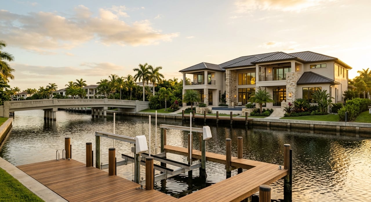
Southeast Cape Coral: Most Direct River Access
For many boaters, southeast Cape Coral is the easiest part of the city to understand. This area connects directly toward the Caloosahatchee River, which then leads west toward the Gulf. The city specifically notes that Rosen Park on the Chantry Canal reaches the Gulf via the Caloosahatchee River and sits about 11.2 statute miles from the Sanibel Causeway Bridge. Horton Park on the Everest Canal also reaches the Gulf by way of the river and is about 10.9 statute miles from that bridge. Those details appear on the city’s boating and beach access page.
The city’s paddling guide adds even more clarity. It states that Rosen on the Chantry Canal connects to the Caloosahatchee River north of the Midpoint Bridge, while Horton on the Everest Canal connects just south of the Midpoint Bridge. Four Mile Cove also provides saltwater access to the river. For a buyer, that means many southeast routes are more straightforward than people expect.
If your boating goals include quicker river access, this is often the benchmark zone to compare against. It is especially useful when you want a clearer answer to the question, “How directly can I get out?”
Southwest and Northwest Routes Need More Planning
Southwest and northwest Cape Coral can still be attractive for boat owners, but these areas often require closer review of the actual route. In the northwest, the city’s kayaking page notes that Burnt Store Boat Ramp enters the Rosemary Canal and leads to Matlacha Pass. The city boat-ramp map also shows saltwater launch patterns tied to the North Spreader Waterway and Rosemary Canal, which helps explain why these routes are less direct than the river-facing southeast zone. You can see those launch locations on the city’s boat ramps and basins map.
That difference does not automatically make one area better than another. It simply means your ideal location depends on your boat type and how you plan to use it. A center console, pontoon, or lower-profile powerboat may fit a route that feels less practical for a taller vessel.
A current update also matters in southwest Cape Coral. The city reports that the Chiquita Lock Removal Project was completed on June 17, 2025, and notes that shallow areas may remain near the former lock site. So if you are evaluating Southwest Spreader or Camelot-area boating, it is smart to treat access as evolving rather than relying on older assumptions.
Bridge Heights: The Numbers That Matter
Bridge height is one of the most important parts of Cape Coral boating, but it is often misunderstood. The two major river crossings that shape local navigation are the Cape Coral Bridge and the Midpoint Memorial Bridge. According to Lee County and the bridge project navigation survey, both offer 55 feet of vertical clearance at the center.
The Cape Coral Bridge navigation survey lists 55 feet of vertical clearance and 90 feet of horizontal clearance. Lee County also states that the Midpoint Memorial Bridge has 55 feet of vertical clearance and 200 feet of channel width in the shipping channel. For many typical recreational boats on the river corridor, these bridges are not the main day-to-day obstacle. But for taller vessels, that 55-foot number becomes a hard planning limit.
Why 55 Feet Often Is Not the Biggest Issue
If you run a typical powerboat, bay boat, center console, or pontoon, the Cape Coral and Midpoint bridges may not be the factor that changes your buying decision. They still matter, but they are often more relevant for taller boats with towers, antennas, or other height concerns. That is why many buyers should focus first on canal type and route pattern, then on bridge clearance.
In other words, a home described as Gulf access may still feel very different depending on whether your route is river-facing and simple or more indirect and height-sensitive. The bridge number is important, but it is only part of the full boating picture.
Matlacha Pass Bridge Changes the Northwest Equation
If you are looking in northwest Cape Coral, the bridge conversation changes. The key constraint there is the Matlacha Pass Bridge on Pine Island Road. Waterway Guide’s bridge listing reports a closed vertical clearance of 9 feet and notes that the drawbridge opens on signal.
That is a very different situation from the fixed 55-foot bridges on the river corridor. In practical terms, the northwest route is much more sensitive to boat height and bridge timing. For some boats, that may be a minor inconvenience. For others, it can be a major route-planning issue.
What This Means for Different Boaters
The most useful way to shop for waterfront property in Cape Coral is to match your boating style to the access pattern.
Freshwater Buyers
Freshwater areas are often a good fit if you want:
- Inland cruising
- Kayaking and paddle access
- Lake connections
- A simpler route system
- Waterfront living without Gulf-access priorities
These homes can absolutely support an active water-focused lifestyle. They are just serving a different kind of boating use.
River-Facing Saltwater Buyers
Southeast Cape Coral is often the strongest fit if you want:
- More direct access to the Caloosahatchee River
- A simpler path toward Gulf-bound boating
- Fewer route complications than spreader-based areas
- Easier comparison shopping for Gulf-access homes
For many out-of-area buyers, this is the easiest zone to understand quickly.
Bridge-Sensitive Saltwater Buyers
Southwest and northwest areas can make sense if you want saltwater access but are comfortable with:
- Longer or more route-specific navigation
- Bridge considerations
- Water depth awareness in certain areas
- Access conditions that may change over time
These locations can still be a strong match, especially when the property itself checks every other box. You just want a clear understanding of how the route works for your boat.
Use Public Maps Carefully
Cape Coral’s public maps are useful for broad education, but the city makes an important point: its maps are intended for internal use, may require staff interpretation, and should not be used for navigation or engineering calculations. You can see that guidance on the city’s maps and document hub.
That is especially important when you are house hunting online. Public sources can help you understand freshwater versus saltwater, likely access patterns, and major bridge issues. But when you are narrowing down a property, the real question is how that specific lot and route fit your boat and your boating goals.
How to Shop Smarter for Cape Coral Boat Access
When you compare homes, ask these questions early:
- Is the property on a freshwater or saltwater canal?
- If it is saltwater, is the route river-facing or spreader-dependent?
- Will you pass under a fixed bridge or depend on a drawbridge?
- How much does your boat’s height matter?
- Are there changing conditions, like shallow areas near former lock sites, that should be part of your review?
These questions can save you time and help you avoid falling in love with a home that does not match the way you want to use the water.
If you want help narrowing down Cape Coral waterfront homes based on actual boating goals, Chuck Shepherd can help you compare freshwater, river-access, and bridge-sensitive options so you can buy with more confidence.
FAQs
Which Cape Coral areas are freshwater only for boating?
- Cape Coral’s Canalwatch report groups freshwater areas into FW-G, FW-N, and FW-S, including Alligator Slough tributaries and other inland canal systems that are better suited to inland boating, lakes, and paddling rather than direct Gulf access.
Which Cape Coral boating area has the most direct river access?
- Southeast Cape Coral is generally the most direct river-facing saltwater zone, with public access points like Rosen Park and Horton Park connecting to the Caloosahatchee River.
How much do the Cape Coral Bridge and Midpoint Bridge matter for boat height?
- Both bridges have 55 feet of vertical clearance at the center, so they are a hard limit for taller vessels, though many common recreational powerboats are not affected the same way.
Why is the Matlacha Pass Bridge important for northwest Cape Coral boating?
- The Matlacha Pass Bridge has a closed vertical clearance of 9 feet and opens on signal, making northwest routes much more sensitive to boat height and bridge timing.
How did the Chiquita Lock removal affect Southwest Cape Coral boating?
- The city says the Chiquita Lock Removal Project was completed on June 17, 2025, and shallow areas may remain near the former lock site, so Southwest access should be treated as changing rather than based on the old lock setup.
Can Cape Coral city maps confirm exact boating routes for a home purchase?
- No. The city says its public maps are useful for general understanding but should not be used for navigation or engineering calculations.